
Discovery trail of "la Palunette" at the Marais du Vigueirat
Cultural Pedestrian sports Course
Presentation

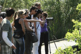
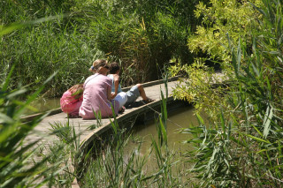
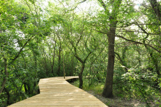
A 2.5 km route where you will discover, along the canal du Vigueirat, the typical Camargue landscapes, and discover the different species of birds through a wildlife observatory.
The Marais du Vigueirat, property of the Conservatoire du littoral, covers 1200 hectares, at the junction of two remarkable ecosystems, the Rhone delta and the steppe plain of the Crau. Many plant and animal species can be observed there (more than 300 species of birds observed). Kilometers of paths will allow you to discover this exceptional natural space, on foot or in a horse-drawn carriage, with a free or guided tour.
The Etourneau trails (Sentier des Cabanes - Sentier de la Palunette) are not free.
The Etourneau trails (Sentier des Cabanes - Sentier de la Palunette) are not free.
Opening period (s)From 01/01 to 31/12 between 9 am and 5 pm.
Labels
- Departments of Provence Alpes Côte d'Azur :
- Departments of Provence Alpes Côte d'Azur
Practical information
- Route :
- Signposted route
- Distance (km) : 2.5
- Route : BOUCLE
- Tourist itinerary :
- Tourist itinerary
- Park :
- Camargue Regional Nature Park
Prices
Adult: 6 €
Child (6-12 years): 3 €.
Free entry for children < 6 years.
This entrance fee gives you access to all the paths of the Marais du Vigueirat.
Child (6-12 years): 3 €.
Free entry for children < 6 years.
This entrance fee gives you access to all the paths of the Marais du Vigueirat.
Contact
Discovery trail of "la Palunette" at the Marais du Vigueirat
Chemin de l'Etourneau
Mas Thibert
13104
Arles
Phone : +33 4 90 98 70 91
- Spoken language(s) :

Destination
Sentier découverte de "la Palunette" aux Marais du Vigueirat
Chemin de l'Etourneau
Mas Thibert
13104
Arles
GPS coordinates
Latitude : 43.536227
Longitude : 4.753409
We also suggest ...
Package containing the object

A 500-metre playful course entirely on stilts.
-
Route :
- Distance (km) : 0.5
The Marais du Vigueirat is a protected natural site of 1,200 hectares at the junction of two remarkable ecosystems: the Rhone delta and the steppe ...
On site
Over an area of one hectare, you can discover different environments, the plants that make them up and their relationship with man.
-
Route :
- Distance (km) : 0.7