The sea wall
Sport Pedestrian sports Hiking itineraryPresentation
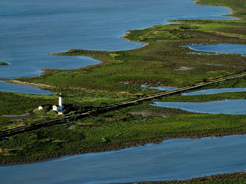
The dam to the sea was built in 1859 to protect the Camargue to marine intrusions. The exchange of water between the sea and the ponds are made through valves, known as pertuis.
Itinerary:
1 parking at the lighthouse Gacholle (parking of the Countess), take the dam to the sea in the direction of the Gacholle lighthouse. In front of the lighthouse and continue for 3 km on the trails. You enter the territory of the National Reserve of Camargue which is a wild area very rich but also very fragile. As a result, stay on the seawall and the indicated paths.
2. you can admire the beach by taking the path left near the old customs post. Otherwise continue on the dike to the sea until the Rousty Pertuis.
3 from the Pertuis de Rousty, you can join the Saintes-Maries beyond-sea by continuing the dike. The village lies 6 km from this point.At the start of the Saintes-Maries-de-la-Mer: take the course in reverse.
Extension to Giraud - 34 km return saline (Mas Saint Bertrand to 9 km) out of the lighthouse turn left. Cross the parking lot of the lighthouse (the Countess Park) 1 roll up to the Observatory of the flamingos, turn left and continue this track then the road. Continue to the junction between the D36b and the D36c. take right, direction Mas Saint Bertrand (Attention closed Wednesday and CB not accepted) single point refueling before Salin de Giraud. Continue until the D36. take to the right for 2 km towards Salin de Giraud.
Opening period (s)All year round
Practical information
- Price :
- Free
- Visits :
- you can visit it
- Average group visit length (minutes) : 240
- Cycle sports :
- Cycling sports
- Cycle tourism route
- Tourist itinerary :
- Tourist itinerary
- Park :
- Camargue Regional Nature Park
Tarifs
Free of charge.
Contact
The sea wall
La digue à la mer
13200
Arles
Destination
La digue à la mer
La digue à la mer
13200
Arles
GPS coordinates
Latitude : 43.676651
Longitude : 4.627804


