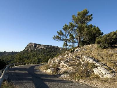
Towards the Durance valley
SportPresentation
Tourist route to spend a day between Aix-en-Provence and the Durance valley.
The Aix countryside is magical: it gives the impression of evolving in an impressionist painting! The streets of the city then the beautiful bastides set the tone while the Sainte Victoire mountain appears little by little. The car passes through Vauvenargues and then crosses the Massif de Concors. After Jouques, the itinerary follows the banks of the Durance and the Canal de Marseille to reach Saint-Paul-les-Durance. On the way back, the Mirabeau bridge appears with the Durance and the Luberon in the background. From Peyrolles-en-Provence to Puy-Sainte-Réparade, the landscapes of the Durance Valley take shape. Then, the Departmental road 14 winds around the hill of La Quille and the Chaine de la Trévaresse. The large wooded areas give way to agricultural landscapes supplied with water by the Touloubre. The Pinchinats Valley, a natural water reserve, marks a green return to Aix thanks to the shade of the trees and the quietness of the country houses.
Opening period (s)All year round.
Practical information
- Route :
- Distance (km) : 96
- Daily duration (minutes) : 420
- Route : BOUCLE
- Visits :
- Average individual visit length (minutes) 420
- Natures field :
- Hard coating (tar, cement, flooring)
- Activities :
- Tourist routes
- Park :
- Park
Tarifs
Free access.
Contact
Towards the Durance valley
Office de Tourisme
13100
Aix-en-Provence
Destination
Vers la vallée de la Durance
Office de Tourisme
13100
Aix-en-Provence
GPS coordinates
Latitude : 43.525639
Longitude : 5.444639


