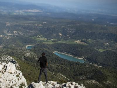
The tour of the Sainte-Victoire mountain
SportPresentation
A beautiful road of 62km to be made by car: One sees it of far the Sainte-Victoire mountain presenting a different face according to the way in which
as expressive as the villages which make the round around it...
around it...
as expressive as the villages which make the round around it...
around it...
Mineral and almost bluish, the massif presents many faces. Here and there, the possibilities for walks are as numerous as they are attractive. For example, it is possible to reach the Imoucha trail leading to the Provence cross from Saint-Marc-Jaumegarde. The itinerary continues through Vauvenargues, which houses a castle famous for having been the property of Picasso. The Col des Portes leads to the heart of the departmental forest of Puits d'Auzon, then the road continues to Puyloubier. The view of the Sainte Victoire Mountain is breathtaking, while to the north the road runs along the Cengle bar. In Saint-Antonin sur Bayon, a reception area informs visitors about the specificities of these protected sites. Then, the departmental road takes the name of Route Cézanne, the only road classified as a Historic Monument, and returns to Aix via a shaded road through the Roques Hautes estate and Le Tholonet.
From the Aix-en-Provence Tourist Office, take Avenue Victor Hugo to the right on Place Charles de Gaulle and then turn left onto Boulevard du Roi René. Turn left on boulevard Carnot and then right on Cours des Arts et Métiers to join the RD10 in the direction of Vauvenargues. Along this road, you will go along the Bimont dam then cross the town of Vauvenargues.
At the crossroads with the RD11, turn right in order to continue on the RD10 until the limit of the department then in its continuation, on the RD223. You will pass by the Col des Portes and then some ideal areas for a picnic break.
At the crossroads with the RD23 turn right towards Pourrières.
After crossing this village, turn right on the RD623 (RD57d in the Bouches-du-Rhône department) towards Puyloubier.
Cross the village of Puyloubier and continue to the right on the RD17 to Aix-en-Provence. Before reaching the tourist office of Aix, you will cross on your road the eco-museum of the Sainte Victoire, then many possibilities to make breaks on the Cézanne road, in particular in Le Tholonet.
Opening period (s)All year round.
Practical information
- Route :
- Distance (km) : 62
- Route : BOUCLE
- Natures field :
- Hard coating (tar, cement, flooring)
- Activities :
- Tourist routes
- Park :
- Park
Tarifs
Free access.
Contact
The tour of the Sainte-Victoire mountain
Aix-en-Provence
13090
Aix-en-Provence
Destination
Le tour de la montagne Sainte-Victoire
Aix-en-Provence
13090
Aix-en-Provence
GPS coordinates
Latitude : 43.525611
Longitude : 5.444667


