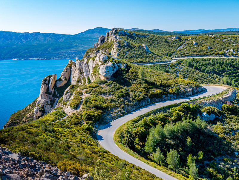
From Marseille to La Ciotat by the route des Crêtes
SportPresentation
A beautiful 35km drive. You go along the National Park of Calanques, taking height above Marseille, Cassis and La Ciotat. Breathtaking ridges.
Between sky and sea, between creeks and ridges, the landscape is breathtaking and nature is abundant! Of course, the contrast is great between the urban beaches of Marseille and the wild nature of the calanques! But it is incongruous to discover in the middle of the city these bathing places laid out along the coastline like so many invitations to leisure. Then nature takes over again, omnipresent from Luminy with its limestone hills populated with pine trees. The ascent of the Gineste pass leads to Cassis, nestled between the high golden cliffs of Cap Canaille and the white majesty of the Calanques. The road of the crests offers a sumptuous vision, embracing the open sea. The national park of the Calanques spreads over 5000 hectares, a delight for sportsmen and women as well as for the contemplative ones. Finally, the botanical wealth of the Mugel park in La Ciotat is worth the detour!
From the Prado beaches in Marseille, take the Boulevard du Prado to the Rond point du Prado in front of the Parc Chanot entrance. Take the RD559 on the right or boulevard Michelet in the direction of Mazargues. Pass in front of the Velodrome stadium on your left and continue until the obelisk of Mazargues. Continue on the RD559 towards Cassis.
After about 3km through the neighborhoods of Redon and Luminy, turn left on the roundabout towards Cassis. You will reach the first laces of the col de la Gineste. At the end of the hill, the road continues through Carpiagne for about 5 km before starting the descent towards Cassis.
Continue on the RD559 which bypasses the town of Cassis in the direction of La Ciotat. If you have the opportunity, don't hesitate to stroll in the alleys of Cassis before taking the road again.
At the exit of Cassis, take the RD141 on the right. This winding road overhanging the sea, called "Route des Crêtes" will allow you to reach the outskirts of La Ciotat. The Tourist Office of La Ciotat is located near the port, on the boulevard Anatole France.
The section between Cassis and La Ciotat known as the ‘Route des Crêtes’ is pedestrianised every Sunday throughout the year, with motor vehicles prohibited.
From 1 June to 30 September, the road may be closed depending on access conditions to the Calanques National Park.
Opening period (s)All year round daily.
Practical information
- Route :
- Distance (km) : 35
- Daily duration (minutes) : 180
- Route : Aller / Itinerance
- Visits :
- Average individual visit length (minutes) 180
- Natures field :
- Hard coating (tar, cement, flooring)
- Activities :
- Tourist routes
- Park :
- Calanques National Park
Tarifs
Free access.
Contact
From Marseille to La Ciotat by the route des Crêtes
Plages du Prado
13055
Marseille
Destination
De Marseille à La Ciotat par la route des Crêtes
Plages du Prado
13055
Marseille
GPS coordinates
Latitude : 43.261806
Longitude : 5.374611


