Water trail in the city centre
Pedestrian sports, Course, Hiking itinerary Interdepartmental InterdepartmentalItinéraire
 Departure/Arrival
 Point of interest
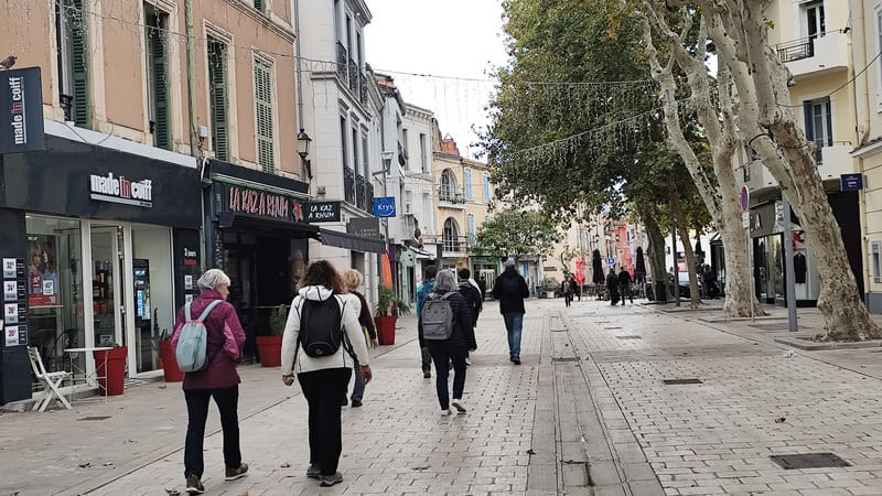
Point 1 - Departure from the Tourist Office
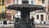
Join the Place de la Libération via the Miroir aux Oiseaux. The fountain in front of you was installed on this square in 1881 to celebrate the arrival of fresh water from the Durance via the Martigues canal.
Continue towards Place Mirabeau, stopping in front of the façade of the Sainte Madeleine church on the far right (to the north) there was a fountain still visible in the 1920s. Place Mirabeau, this fountain was moved to Place Mirabeau in 1862. The fountain you can see was brought from the Jonquières district in 1961. It replaced the pump fountain from 1947. In 1954, the city had small pump fountains installed in the districts, including one opposite No. 8 Place Mirabeau. There were 30 pumps (there is one at the entrance to the Parc des sports Julien Olive).
Continue towards Place Mirabeau, stopping in front of the façade of the Sainte Madeleine church on the far right (to the north) there was a fountain still visible in the 1920s. Place Mirabeau, this fountain was moved to Place Mirabeau in 1862. The fountain you can see was brought from the Jonquières district in 1961. It replaced the pump fountain from 1947. In 1954, the city had small pump fountains installed in the districts, including one opposite No. 8 Place Mirabeau. There were 30 pumps (there is one at the entrance to the Parc des sports Julien Olive).
Point 2 - Head towards the Ferrières Garden
Take Rue Galinière to see a fountain in the shape of jars on Place Félix Gras. Continue straight. At the beginning of this street there was a small square: the plan de cour (place comtat) which had a fountain that was fed from the pipeline by Rue de la Chaîne and the crossing of the Baussengue canal by an inverted siphon.
Cross the road and the blue bridge towards the Jardin de Ferrières.
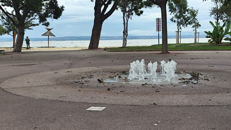
At the beginning of it there is a series of 12 water jets which replace a pretty fountain until then in this place.
At the first aid station (the fountain with water jets dates from 2021), turn left on Bd du 14 Juillet for 50m
At the intersection with rue Salengro (on your left), here was the Puits Marguière, this well, on the edge of the old ramparts just before the Porte Marguière, only appeared from 1542, it was one of the two main wells of Ferrières. He disappears with the ramparts.
Take the Bd Fleming (which is the old road to St Miter les Remparts), until the junction with the Allée Lavoisier.
Cross the road and the blue bridge towards the Jardin de Ferrières.
At the beginning of it there is a series of 12 water jets which replace a pretty fountain until then in this place.
At the first aid station (the fountain with water jets dates from 2021), turn left on Bd du 14 Juillet for 50m
At the intersection with rue Salengro (on your left), here was the Puits Marguière, this well, on the edge of the old ramparts just before the Porte Marguière, only appeared from 1542, it was one of the two main wells of Ferrières. He disappears with the ramparts.
Take the Bd Fleming (which is the old road to St Miter les Remparts), until the junction with the Allée Lavoisier.
Point 3 - Towards the old Serre basin
Turn right into the Allée des Promeneurs.
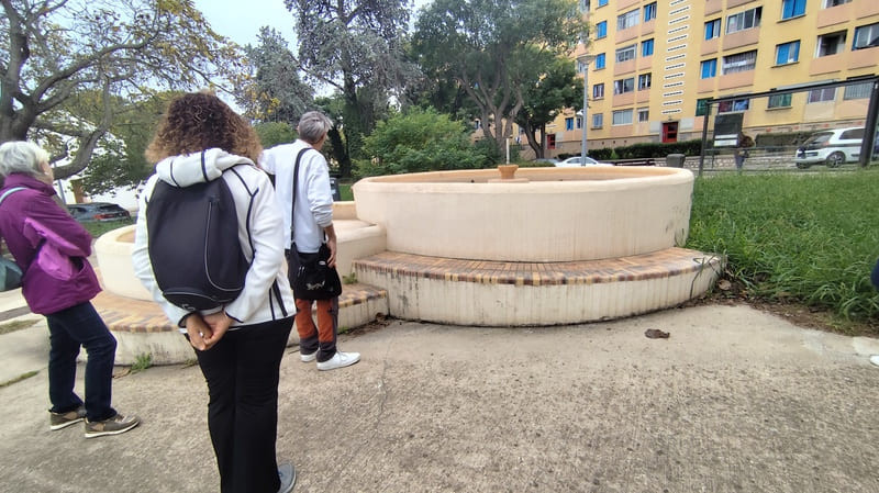
At the end of this you come to a square with a pretty fountain, dating from around 1964.
Take a slight right (30m) you find yourself at the old Bassin de la Greenhouse.
It was for a long time the seat of the water service (see inscription on the facade): it is currently the Archaeological Service.
During the construction of the Martigues canal (1858-1886), there was a 30m3 water storage basin in order to supply the districts of the island and Ferrières. Later a 750m3 water tower was built to increase the pressure. All the structures were destroyed in 2009.
From this point we will follow the underground pipe which brought water to the district of Ferrières, then to the Island.
For that, let's go down the Bd Joliot Curie.
At the intersection with the Bd du 14 Juillet, there was a basin. Cross the Boulevard and turn left following the remains of the old rampart.
Take the rue du Colonel Denfert, you come out in the place J.Jaurès.
Point 4 - The blue bridge
Let us return to the place J.Jaurès (former place of the palace).
At the site of the pizzeria there was a fountain which also served as a washhouse dating from 1659, the pools were protected by a stone awning.
This fountain was supplied directly from Tholon and was dismantled in 1863 and replaced by the old fountain which was at the level of the blue bridge.
In 1863, a fountain was also installed on Place J. Jaures, a fountain with a circular base and positioned in front of the bakery.
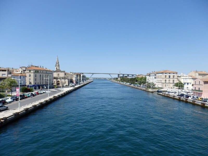
Cross the blue bridge, at the end of it, continue for a very short distance on Quai Toulmond, and take a slight left on rue E. Pelletan.
At No. 12 E. Pelletan in this house directly above the walls, there are wells. For many centuries the shortage of fresh water affected Martigues.
Also, many houses had wells which although giving brackish water were very used.
This habit led to many diseases (in 1752 there were 42 wells). Under the Ile district there was a layer of fresh water surrounded by salt water.
Continue along the street to cross a bridge. Pass in front of the statues of Bourvil and Fernandel then follow the quay to the end to arrive at Pointe San-Crist.
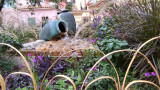
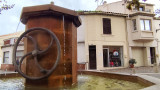
Pointe San-Crist: this esplanade was developed in 2010. It includes water features and small waterfalls, all with a play of lights, all designed by Pierre LUU.
At the beginning of this esplanade, you will find the pier for the free shuttle that will allow you to cross the Gallifet Canal.
At the site of the pizzeria there was a fountain which also served as a washhouse dating from 1659, the pools were protected by a stone awning.
This fountain was supplied directly from Tholon and was dismantled in 1863 and replaced by the old fountain which was at the level of the blue bridge.
In 1863, a fountain was also installed on Place J. Jaures, a fountain with a circular base and positioned in front of the bakery.
Cross the blue bridge, at the end of it, continue for a very short distance on Quai Toulmond, and take a slight left on rue E. Pelletan.
At No. 12 E. Pelletan in this house directly above the walls, there are wells. For many centuries the shortage of fresh water affected Martigues.
Also, many houses had wells which although giving brackish water were very used.
This habit led to many diseases (in 1752 there were 42 wells). Under the Ile district there was a layer of fresh water surrounded by salt water.
Continue along the street to cross a bridge. Pass in front of the statues of Bourvil and Fernandel then follow the quay to the end to arrive at Pointe San-Crist.
Pointe San-Crist: this esplanade was developed in 2010. It includes water features and small waterfalls, all with a play of lights, all designed by Pierre LUU.
At the beginning of this esplanade, you will find the pier for the free shuttle that will allow you to cross the Gallifet Canal.
Point 5 - The Jonquières district
Take Bd L.Degut, at the end of this Bd at the crossroads, turn left (Rue Amavet) in front of the clinic.
It was the site of the Puit Neuf which appeared in 1324 and after expansion work became the large well. It was located at 9bis rue Amavet.
Continue along Rue Amavet and turn right onto Bd C. Pelletan. Turn left onto Boulevard Marcel Cachin until you reach Place du 8 Mai 1945.
After crossing the roundabout.
At the traffic lights, turn right for 50m. The crèche du 8 Mai houses a 4000 m3 tank in its basement, which was built in 1905 and was filled by an underground pipe connecting it to the greenhouse basin. As the flow rate was insufficient, this tank was connected to the water from the Marseille canal by a pipe that we will follow.
This pipe passes behind the MJC (Bd E. Herriot) to reach St Anne.
At this location there was the Chapelle St Anne as well as the Courradou fountain renovated in 1608.
Continue along Boulevard Edouard Herriot, then turn left onto Av F. Mistral.
Passing in front of Av P. Di Lorto, admire the Fountain at No. 2 (inside private property), continue on Mistral until reaching the small garden (municipal information sign)
A reservoir was installed there between 1613 and 1615 as well as a pipeline to connect the Courradou watercourse to that of the Vabre between 1615 and 1616. Its purpose is to make the connection with the old fountain of the course. In 1887 a washhouse of 19.45m long and 6.85m wide was built there which was covered in 1892.
In 1977 a small fountain could be seen in this garden.
Let's follow the aqueduct down Av F. Mistral. and turn left onto the Esplanade des Belges. Go to the end then turn left at the hotel, after a few meters you will come out onto Place Lafayette.
Point 6 - The Course of September 4
The fountain in Place Lafayette dates from the Middle Ages (14th century), it was known under the name of Vieux Puits.
It was the main well inside the ramparts of Jonquières. It was rebuilt in 1847 later, this fountain took the name of Brandarello.
Take rue L. Gambetta to join the Cours (esplanade of September 4)
In the corner of the "Renaissance" hotel, there was a fountain since 1316 which was supplied by the Vabre aqueduct. This fountain, following a request for expansion, was dismantled in 1961 and then reassembled on Place Mirabeau in Isle. (current fountain). Place des martyrs: a fountain still existed in 1938.
Go towards the fountain of the course at the entrance to rue Lamartine.
This fountain was inaugurated on December 7, 2013.
Enter rue Lamartine. To the right, there is a fountain in Place Tenque.
This fountain dates from the late 80's but before that there were 2 other fountains. One between 1881 and 1885 with a stone support (pump fountain) and the other at the beginning of the 20th century in cast iron. The current fountain made its appearance at the end of the 80s when rue Lamartine was put into a pedestrian street.
Return to the course and reach the fountain opposite the Cascade building.
Like the other fountain in the course, it was inaugurated on December 17, 2013. It replaced a fountain installed in the 1930s.
You can reach your starting point by crossing the lifting bridge, going down the stairs, turning right and following the road to reach the Miroir aux Oiseaux level located at the foot of the Tourist Office.
Presentation
Martigues is a city surrounded by water that was its main wealth for many years
many centuries but this water is salty. This city consists of three districts connected by many bridges, which allowed it to be called "The Provencal Venice".
many centuries but this water is salty. This city consists of three districts connected by many bridges, which allowed it to be called "The Provencal Venice".
Through this hike, you will be able to discover the history of the different water points (fountains, wells, wash houses and aqueducts) that have marked this city through time.
The hike focuses exclusively on the intra-muros works. The departure is from the Tourist Office in order to discover the first fountain. You will continue towards the Boulevard du 14 juillet to make a detour to the outskirts of the city before returning to the city center of Martigues.
You will be able to discover the fountains on the Cours du 4 septembre, on the main squares and the remains of wells and wash houses.
Opening period (s)All year round daily.
Subject to favorable weather.
Subject to favorable weather.
Practical information
- Route :
- Distance (km) : 6
- Daily duration (minutes) : 180
- Route : BOUCLE
- Parking :
- Free car park
- Levels of sporting experience :
- Level green –very easy
Features/Theme
- Environments :
- In centre of town
- Town location
Download
Contact
Rond-point de l'Hôtel de ville
Office de Tourisme de Martigues
13500
Martigues