
Crown Stone Quarry Loop
Pedestrian sports, Hiking itinerary Interdepartmental InterdepartmentalItinéraire
 Departure/Arrival
 Point of interest
Circuit n° 1
Access condition: Between June 1 and September 30, access to forest areas is regulated by prefectural decree and may be by municipal decree, for your safety and the preservation of sensitive sites. Before you follow your “stroll desires”, call 0811 20 13 13. Each day, you will be able to find out whether the site where you want to walk is free access all day, open only in the morning, or completely closed. Depending on the weather conditions, the “forest fire” danger level (orange-red-black) is known no later than 6 pm for the next day.
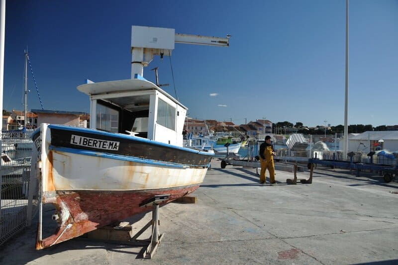
Point 1 - Port de Carro - La Couronne stone quarry loop
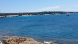
From the small fishing port of Carro.
The main activity of Port de Carro is fishing. Mussel farming (mussel culture) and sea urchin fishing help make this small port a real seafood market.
Take the Verandy quay to the right, pass in front of the Croix de Carro built in homage to the sailors who died at sea.
Carro, a fishing village constantly exposed to the dangers of the sea, had to have a place of worship. Thus, on Easter Monday in the year 1863, the cross blessed in the Church of the Crown was carried by human arms to Carro. Erected at the entrance to the port, it is dedicated to the memory of fishermen who disappeared at sea, a commemorative plaque has reminded us of them since 1822.
You can admire the quarry of the Pointe de Carro.
The organization of the Pointe de Carro quarry dates back to Roman times and recalls the construction of the Pont du Gard blocks.
Then, follow the seaside to the parking lot of the green way, enter the parking lot and take the path marked out in blue which will lead you to the old wastewater treatment plant crossing the burnt area (fire of 26 July 2017).
Point 2 - Wastewater treatment plant - La Couronne stone quarry loop
At the first crossroads, stay to your right and at the second take a slight left towards the old station.
Go around it on the right by taking the DFCI de Bonnieu track. After 50 meters, take the small path on the right and follow the path bordered in places by ruts which leads to the quarry and the Arnettes Semaphore.
In 1806, Napoleon I asked the Ministry of the Navy to set up a device for monitoring ships from land. An artillery officer, Charles Depillon, proposed to the Navy a system inspired by Chappe's telegraph, called Sémaphore. This system consists of a mast on which are articulated 4 arms that can take 301 positions and provide communication with 1,849 distinct signals. Surveillance stations equipped with this device are installed all along the coast, and in particular in Martigues: on the Fort de Bouc, on the plain of Carro and at the Pointe Riche.
On the plain of Carro, in Les Arnettes, the semaphore sensu-stricto dates from 1808. The housing of the lookouts of the post is older, since it was built in 1793. It was at the time a signal post with flags .
In principle, there is a signaling station at each salient point of the coast. This system was very successful and enabled France to equip itself with a coastal surveillance system and a rapid means of communication. The system was put to sleep after the fall of Napoleon I in 1815. The invention of the electric telegraph in 1860 will allow the reopening of the semaphore chain and the construction of numerous posts all along the coast, until the First World War .
Continue on the path straight ahead (marked in blue) towards the railway track, then follow the path on your right to discover the face of the old quarries of Soubrats as well as the bories.
The Soubrats quarry is perhaps a western extension of the Arqueirons quarry, but it was exploited late. A North-South oriented rut road crosses this quarry.
Walk along the railway line, on your right is the Arqueirons quarry.
Mainly exploited from 1664 to 1686 and with an area of 170,000 m2, the site contains traces of in situ habitats: bories, stone huts, galleries.
Point 3 - Railway bridge - La Couronne stone quarry loop
Then cross the small bridge towards Vallon de la Marrane.
Follow the dead end road to the right then take another right before the next “dead end” sign.
Then turn right again towards the Auffans quarry (Operated during the second half of the 19th century, then from 1950 to 2003 for the restoration of historic monuments.).
Take the career path to the right.
Point 4 - RD9e - La Couronne stone quarry loop
Carefully cross the departmental road, then go up the Vallon de l'Eurré.
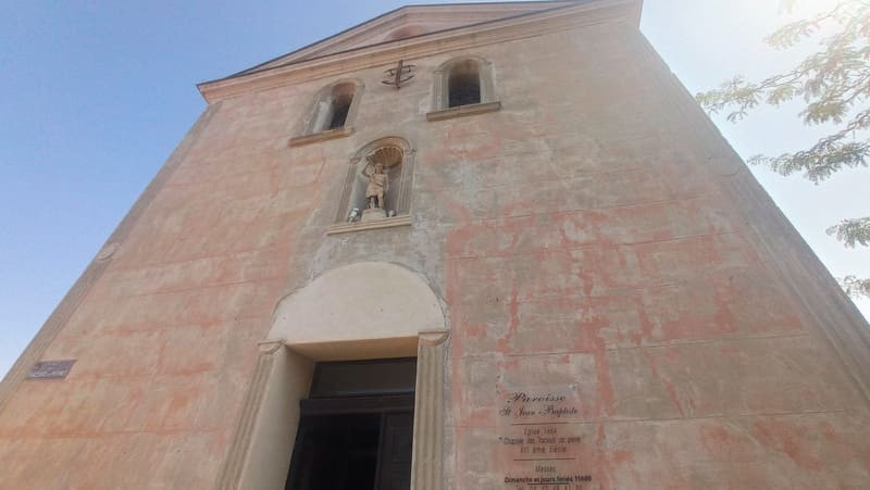
Turn right towards the village of La Couronne, you can admire the Saint-Jean-Baptiste church built in 1859.
The bell tower bears the signature of the master quarrymen.
The bell tower was erected in crown stones in 1666. Each corner stone of the bell tower was thus donated by a quarryman who engraved his mark on it. Inside the church are exhibited quarry's tools. The brotherhood of the Traceurs de Pierre was the driving force behind the creation of the village of La Couronne in the 17th century.
Take the direction of the Phare path then on the left the Petit Mas path, follow the Bernard Nicolas alley on your left, upstream of the multipurpose hall.
At the top of the path, turn left then cross the road to take the green lane on the right on Chemin de la Batterie.
Point 5 - Chemin de la Batterie - La Couronne stone quarries loop
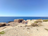
Then turn left into the impasse de la Batterie, you will come to a D.F.C.I. where you have to take the path near the German blockhouse dating from the Second World War.
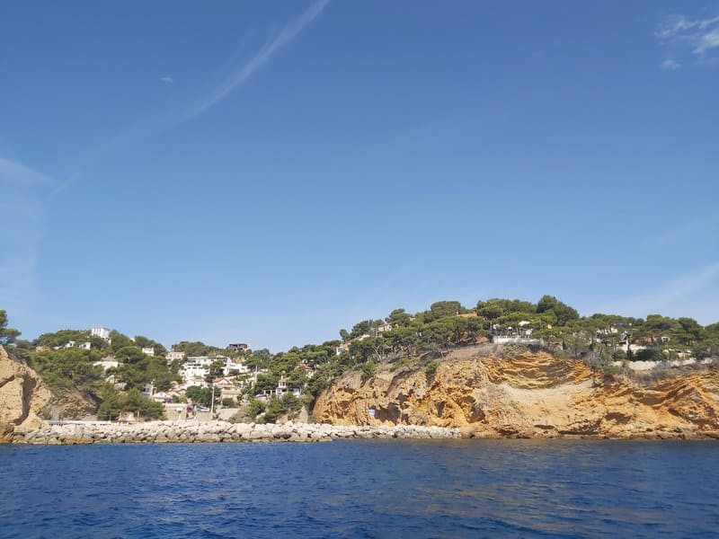
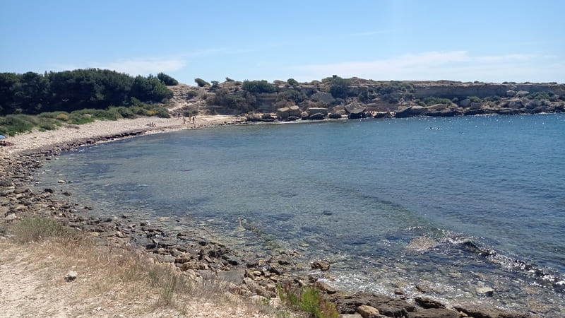
Continue your way to the Beaumaderie plateau, head towards the sea, taking care not to get too close to the edge of the cliff (risk of landslide), you can admire the submerged quarry of Beaumaderie.
The potential of the career is known from the 5th century BC; AD by the presence of the Gallic village of Arquet just above. It is the first Crown stone quarry opened by the Massaliotes during the Hellenistic period. It was used as a port of embarkation in the 18th century.
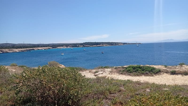
Point 6 - Anse de Beaumadérie - La Couronne stone quarry loop
Take the coastal path to your right towards the Gallic village of Arquet dating from the 6th century.
The village is protected by cliffs overlooking the sea on the south side and defended to the north by a fortification which bars access to the site. The occupation of this habitat extends from the beginning of the 6th century to the end of the 4th century BC. The organization of the dwellings testifies to a structured town planning, composed of elongated blocks served by two streets. There are 35 or 40 of the houses with a single room, quadrangular plan and occupy 9 to 16 m2.
Take the path on your right which runs along Arquet beach, go up towards the tip of Arquet, and follow it in the direction of Couronne Vieille beach.
Walk along it then turn left to discover the submerged Couronne-Vieille quarry and its rutted roads.
The quarry is currently preserved over an area of 1,200 m2. The sea penetrates very deeply into the quarry and sometimes covers it up to the working face. It was undoubtedly exploited during three distinct periods: from late antiquity to the Middle Ages, to the XVIIth century for the great construction sites of Louis XIV and from 1821 to 1912. The materials were shipped to Marseille in-situ, as evidenced by the presence of a semi-circular mooring post.
Follow the path along the Estanié beach towards the Crown Lighthouse erected in 1960, heading towards the cliff.
In the Middle Ages, surveillance systems called “pharots” followed our coasts in order to signal dangers but also to position capes and points. It demonstrated the presence of the Antibes pirates at the Crown in less than 30 minutes by lighting two wood fires. The current lighthouse was erected in 1960. From its height of 30 meters, it projects a red light beam to indicate its position.
Point 7 - Carrières du Verdon staircase - La Couronne stone quarry loop
Take the staircase on your left which goes down to the quarries of Verdon.
Continue towards the beach of la Couronne, walk along the dune and the esplanade, take the stairs to the left towards the Chemin de la Douane.
Continue straight on towards the Baou Tailla path which runs alongside the ancient quarry.
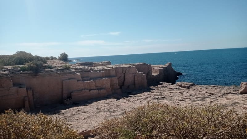
Since antiquity, coastal quarries have been widely exploited to build the main monuments of the Marseille city. They offered a double interest: Outcrops of soft rock, easy to cut, a shell limestone characterized by a pink or yellow color, which belongs to the geological stages of the Burdigalian, in the Tertiary era formed in the Tertiary era.
The coastal location of the quarries facilitates transport by directly boarding the blocks on boats. The Baou Tailla quarry, clearly established above sea level, is one of the best preserved coastal quarries. It is characterized by three large extraction units, distinct from each other by vertical cutting faces. The traces of tools left by the quarrymen make it possible to reconstruct the various extraction operations which demonstrate processes that have changed little from antiquity to the industrial era.
Continue towards Carro beach, and take the footpath on your left which runs along the Rabeton esplanade.
Continue towards the Quai du Vent Large and walk along the port to the Ragues car park.
Continue towards the beach of la Couronne, walk along the dune and the esplanade, take the stairs to the left towards the Chemin de la Douane.
Continue straight on towards the Baou Tailla path which runs alongside the ancient quarry.
Since antiquity, coastal quarries have been widely exploited to build the main monuments of the Marseille city. They offered a double interest: Outcrops of soft rock, easy to cut, a shell limestone characterized by a pink or yellow color, which belongs to the geological stages of the Burdigalian, in the Tertiary era formed in the Tertiary era.
The coastal location of the quarries facilitates transport by directly boarding the blocks on boats. The Baou Tailla quarry, clearly established above sea level, is one of the best preserved coastal quarries. It is characterized by three large extraction units, distinct from each other by vertical cutting faces. The traces of tools left by the quarrymen make it possible to reconstruct the various extraction operations which demonstrate processes that have changed little from antiquity to the industrial era.
Continue towards Carro beach, and take the footpath on your left which runs along the Rabeton esplanade.
Continue towards the Quai du Vent Large and walk along the port to the Ragues car park.
Presentation
Surprising mineral case nestled in the heart of the Côte Bleue. This tourist loop invites you to discover a bend of a major front on the blue of the Mediterranean.
Visit the La Couronne dimension-stone quarries, 3 inland and 5 on the coast, on an 11 km itinerary. Learn about how quarrymen worked over the centuries: discover traces of there work, distinguish different extraction strategies and identify periods of activity.
In detail:
The antique quarries of the Côte Bleue
Massalia needed stone for construction from its foundation in 600BC. The site was not suited to this sort of activity, so the Massaliotes had to find their raw material elsewhere. The first quarries were created on the hewn coastline of the Côte Bleue, not far from Martigues on Cap Couronne, more precisely at Pointe de l’Arquet and the surrounding area. 6 main quarries were worked in antique times, 4 for stone and 2 for pink limestone which was used to build the walls of Massalia and most of its monuments.
Opening period (s)All year round daily.
Subject to favorable weather.
Subject to favorable weather.
Practical information
- Route :
- Signposted route
- Distance (km) : 12
- Daily duration (minutes) : 180
- Route : BOUCLE
- Route : 176
- Parking :
- Free car park
- Levels of sporting experience :
- Level bue - Medium
- Natures field :
- Stone
- Clay
Features/Theme
- Environments :
- Village centre
Download
Photos


We also suggest...


