
The local Boumandariel circular route
Pedestrian sports, Hiking itinerary Interdepartmental InterdepartmentalItinéraire
 Departure/Arrival
 Point of interest
Circuit n° 1
Access condition: Between June 1 and September 30, access to forest areas is regulated by prefectural decree and may be by municipal decree, for your safety and the preservation of sensitive sites. Before you follow your “stroll desires”, call 0811 20 13 13. Each day, you will be able to find out whether the site where you want to walk is free access all day, open only in the morning, or completely closed. Depending on the weather conditions, the “forest fire” danger level (orange-red-black) is known no later than 6 pm for the next day.
Point 1 - Launching - Boumandariel loop
From the Boumandariel launch, take the stairs on your right that lead to the Tamaris plateau.
On this plateau you can discover the Gallic village dating from the 6th century. The Gallic village was established on this site at the beginning of the 6th century BC The coastal installation allows the local population to benefit from the food resources of the sea and inland, but also from maritime trade. Greek and Etruscan. The village represented a vast agglomeration of nearly 1.5 ha protected to the south by cliffs and to the north by two lines of fortifications which split it into two parts.
Succeeding houses of wood and cob, the built-in village which developed from the first quarter of the 4th century BC shows the arrangement of dwellings in various shapes, organized along the axes of circulation. : single-room houses isolated from each other or grouped together in blocks, houses with several rooms in a row or with a courtyard vestibule.
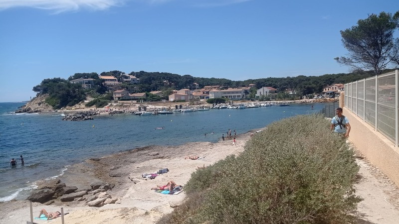
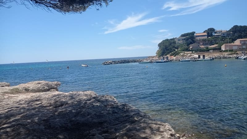
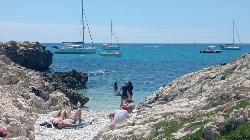
Point 2 - Port des Tamaris - Boumandariel loop
Follow the path marked in blue towards the Port des Tamaris.
Take the Chemin des Tamaris on the left, walk along the Anse des Tamaris and its small port.
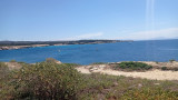
The anchorage and light equipment area of Anse des Tamaris is one of the sites dedicated to accommodating pleasure boats during the summer. It is a natural shelter for boats, protected from prevailing winds and currents. At the beginning of the 20th century, several small wooden wharves were positioned around the small cove in a disparate manner. The current development of the "Port des Tamaris" dates from 1981, with the installation of the first two wharves. Two other wharfs were put in place in the 1990s. The shore was then fitted out with riprap and the port was protected to the south by a small riprap dyke.
Go up the stairs to the Sainte-Croix plateau, where you will meet a German radar station dating from World War II.
During World War II, the Germans set up a station on the site made up of two giant Wurzburg Riese Fuse 65 radars and two Freya FU MG 80. Two sections each comprising three 2 cm Flack 30 guns were to provide anti-aircraft defense and machine guns in tobrouk, close defense. On its western slope, two medium-caliber guns in an H612 casemate protected the small cove and the access roads.
On its eastern slope, an H612 casemate cannon held the Anse des Tamaris under fire, supported by an anti-tank gun, tobrouk machine guns, an R35 tank turret, a 150 cm searchlight: all connected by trenches .
Take the Chemin des Tamaris on the left, walk along the Anse des Tamaris and its small port.
The anchorage and light equipment area of Anse des Tamaris is one of the sites dedicated to accommodating pleasure boats during the summer. It is a natural shelter for boats, protected from prevailing winds and currents. At the beginning of the 20th century, several small wooden wharves were positioned around the small cove in a disparate manner. The current development of the "Port des Tamaris" dates from 1981, with the installation of the first two wharves. Two other wharfs were put in place in the 1990s. The shore was then fitted out with riprap and the port was protected to the south by a small riprap dyke.
Go up the stairs to the Sainte-Croix plateau, where you will meet a German radar station dating from World War II.
During World War II, the Germans set up a station on the site made up of two giant Wurzburg Riese Fuse 65 radars and two Freya FU MG 80. Two sections each comprising three 2 cm Flack 30 guns were to provide anti-aircraft defense and machine guns in tobrouk, close defense. On its western slope, two medium-caliber guns in an H612 casemate protected the small cove and the access roads.
On its eastern slope, an H612 casemate cannon held the Anse des Tamaris under fire, supported by an anti-tank gun, tobrouk machine guns, an R35 tank turret, a 150 cm searchlight: all connected by trenches .
Point 3 - Ste-Croix Chapel - Boumandariel loop
Go down on your right towards the chapels.
The old 12th century chapel was built by the Benedictine monks of the Saint Genest priory in Jonquières who dedicated it to the Holy Cross. Called "Santo Terro" by sailors, this place and its sanctuary belonged to the parish of Jonquières until the revolution. This is why the Penitents from the 3 districts of Martigues went there on pilgrimage on May 3 and September 14 to honor the Savior's cross. They also celebrated Lent and Easter masses there. We do not know the reason which pushed the Clergy to abandon the old chapel to build a new one in the 17th century. Four columns from the old chapel have taken place in the new sanctuary, they are the link between the two holy places.
The old 12th century chapel was built by the Benedictine monks of the Saint Genest priory in Jonquières who dedicated it to the Holy Cross. Called "Santo Terro" by sailors, this place and its sanctuary belonged to the parish of Jonquières until the revolution. This is why the Penitents from the 3 districts of Martigues went there on pilgrimage on May 3 and September 14 to honor the Savior's cross. They also celebrated Lent and Easter masses there. We do not know the reason which pushed the Clergy to abandon the old chapel to build a new one in the 17th century. Four columns from the old chapel have taken place in the new sanctuary, they are the link between the two holy places.
Point 4 - Campsite - Boumandariel loop
At the end of the plateau, turn right towards the footpath.
Walk along the car park, leaving it on your right, you will come to a roundabout.
Continue straight ahead and take the green lane.
Go up the footpath that borders the pine forest.
Walk along the car park, leaving it on your right, you will come to a roundabout.
Continue straight ahead and take the green lane.
Go up the footpath that borders the pine forest.
Point 5 - Les Rouges roundabout - Boumandariel loop
At the roundabout, carefully cross the departmental road RD49 then take the direction "les Rouges".
Go right near the D.F.C.I. and follow the blue marked path on your right.
The next descent is to be taken slowly.
Go right near the D.F.C.I. and follow the blue marked path on your right.
The next descent is to be taken slowly.
Point 6 - Mare de Boumandariel - Boumandariel loop
Then, on your right, walk along the reed bed of Grand Vallat and the pond of Boumandariel.
This area conceals many floristic curiosities such as the broom reed (sagne) as well as fauna such as the nutria (marsh beaver).
This area conceals many floristic curiosities such as the broom reed (sagne) as well as fauna such as the nutria (marsh beaver).
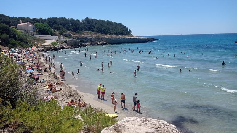
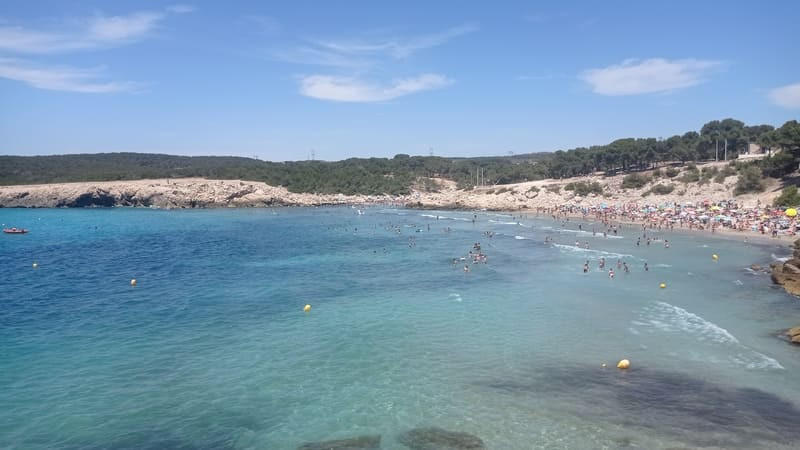
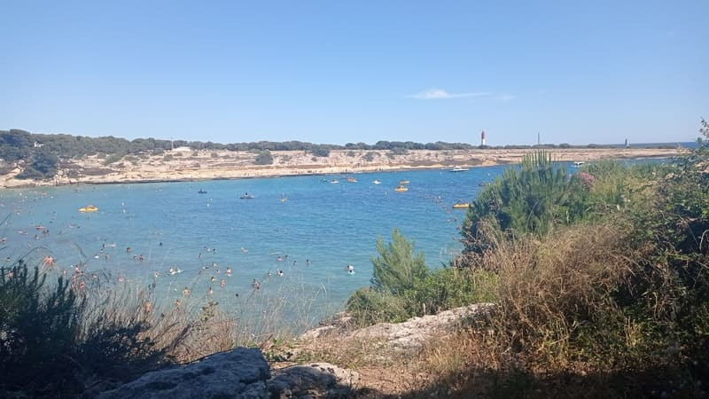
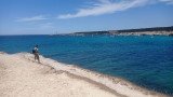
Point 7 - Four à Chaux cove - RD49 - Boumandariel loop
At the end of the path, carefully cross the RD49 departmental road then take the direction of the Grand-Vallat beach on your right.
This sandy beach protects the reed bed downstream: it is a wetland where reeds grow which shelter a very varied fauna including mammals (nutria), amphibians (southern tree frog), birds (hen and water rail). , reptiles (viperine snake) and aquatic insects (beetle and gerris).
Go to the edge of the quarry and take the stairs that will take you to the quarry of Boumandariel cove.
In the quarry of Anse de Boumandariel, the formations of the Lower Aquitanian emerge. These rest in discordance on the white limestone banks of the Urgonian presenting a dip of 30 ° towards the South. The Aquitanian is at this conglomerate site with little changed limestone elements, inherited from the substratum and embedded in a sandy material.
Then on your right, walk along the seaside and the Four à Chaux cove to return to your starting point.
Presentation
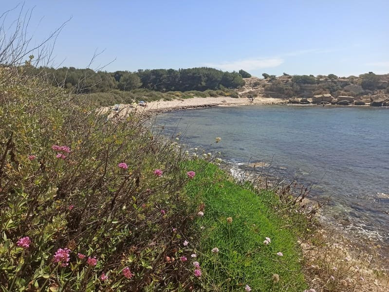
This trail will allow you to discover the tremendous diversity of marine and terrestrial vegetation. You too will fall in love with this deluge of colors and scents.
The local Boumandariel circular route, 5 km 500 metres in length, covers the southern coastal section of the Martigues commune. It is ideal for discovering the exceptional natural flora and fauna.
In detail:
River bed, reed bed and Boumandariel marsh
Reed beds are relatively simple ecosystems, consisting mainly of a single plant species - the common reed (Phragmites australis) which is a perennial grass. The roots and rhizomes dig down to 80cm in flooded soil or sodden soil. They grow in a range of different aquatic environments such as shallow marshes, around ponds and on the banks of canals and rivers. Despite having little floral interest, reeds are very important for the conservation of animal species, some of which are completely dependent on this environment.
As a result of their role as a shelter to fauna, particularly birds and invertebrates, reeds are very precious to the environment. They are considered to be a crucial habitat for the biodiversity, particularly for water birds.
Species which are vulnerable and rare in Europe such as certain herons, ducks, birds of prey and passerines reproduce in reed beds. They also provide an interface with the aquatic environment for other species seeking protection in wetlands for their perches, such as dormitories for swallows and starlings. Reed beds also play a role in the natural infrastructure: they protect banks from erosion and help to purify the air by absorbing nutriments (phosphates and nitrates), oxygenating and stabilising heavy metals.
Opening period (s)All year round daily.
Subject to favorable weather.
Subject to favorable weather.
Practical information
- Route :
- Signposted route
- Distance (km) : 5.7
- Daily duration (minutes) : 180
- Route : BOUCLE
- Route : 108
- Parking :
- Free car park
- Levels of sporting experience :
- Level green –very easy
- Natures field :
- Rock
- Stone
- Clay
- Hard coating (tar, cement, flooring)
- Delicate passages :
- - Il existe un petit escalier dans la Anse de Boumandariel qui peut être glissant à cause de petits graviers ronds et des marches usées. - Passage délicat au changement de terrain dans le Chemin des Tamaris (passage proche de l'eau).
Features/Theme
- Environments :
- In the country
- Village 2 km away
Download
Pics


We also suggest...


